|
|
   |
|
|

|
"Do you know this location?
You really know a place when you've been there before, and seen it for yourself. A building here. Park there. School across the street. Mall on the hill to the north... Keyhole makes you instantly location aware about any place on Earth—zooming you from space to street-level aerial views in seconds. Streaming an interactive 3D-model of the Earth, Keyhole is a must-have for anyone making decisions where geography is a factor.
Privacy Policy Cancellation Policy ©2003 Keyhole Inc. Images, ©2003 I-Cubed, ©2003 AirPhotoUSA. Maps © GDT Inc. All rights reserved. |
 |
| Click through our Photo Gallery! |
 |
|
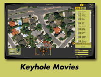
QuickTime movies: Small (1.0 M) Large (4.0 M) |
|
Real Media movies: Small (0.8 M) Large (2.9 M) |
|
Windows Media movies: Small (0.6 M) Large (2.3 M) |
| CCIM Institute Signs Strategic Partnership With Keyhole Corporation |