Do you have a grid reference for a site and need to know which map it is on? Well, finding out is easy!
Just try the megalithomania Grid Reference Locator
Or do you want to convert Irish grid references to longitude and latitude? Or even vice-versa?
Just try the megalithomania Coordinate convertors
Nearest Weather
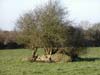
Photo of the exposed site taken during excavation.
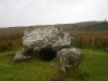
6.8km (W) is a court tomb at Audleystown. 9.4km (WSW) is a portal tomb at Loughmoney. 1.9km (S) is a holy well at St. Coey's Well. 2.8km (N) is a stone row (alignment) at Tullymally. 9.1km (WSW) is a standing stone at Carrownacaw.


")
")
")
")
")
")
")