|
|


"This is the future of commercial real estate."
-
Jay R. Lucas, CCIM
Commercial Real Estate
Keyhole offers Real Estate professionals instant
access to a rich suite of tools for visually
inspecting and analyzing any real estate opportunities:

|
"Staubach Retail Services takes clients on virtual
fly-overs of properties being considered for a site.
By doing so, Staubach and their clients can save
valuable site visit time - eliminating 2 or 3 properties
from consideration without ever leaving the office."
- Janie French, Vice President, Research & Technology,
Staubach Retail Services
|
-
"Fly-through"
your city or your area of interest on your desktop;
-
Fluidly zoom down to a property;
-
Turn on any of your firm's data such as property
availability info, comparables, or MapInfo
generated maps and analysis;
-
Present clients with virtual tours of a property;
Residential Real Estate
"You have to see Keyhole's EarthViewer3D to
believe it. I think that this is how REALTORS© will
want to research and present properties in the future."
- Jay Huffman, President,
MLSNI
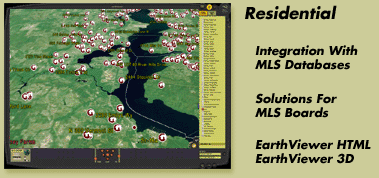
Keyhole's EarthViewer3D offers the ability to visually
inspect aerial images of your city to instantly gain
a perspective on a property. It's like an open house on
your entire city or neighborhood:
Keyhole Wins Aerial Image Contract From Largest
Multiple Listing
Service In The World!
-
"Fly-down" to a newly available property;
-
Turn on MLS/Comp data on any data layer of
relevance such as roads and crime statistics;
-
Annotate the image with your notes, and email a
JPG image of the aerial photograph, with your
annotation, to your client;
-
Use the Keyhole EarthSystem to market your
properties by including aerial views in your
literature or presentations, or integrating
Keyhole's EarthViewer HTML access into your own website;
A Rich Mapping Solution For Real Estate
-
"I think Keyhole's EarthViewer is a tremendous product for
viewing properties and their relationship to the
market area. It makes showing locations to prospects
easy, fast and effortless -- Costly aerial flights
and helicopter rides are a thing of the past thanks
to Keyhole."
- Jay R. Lucas, CCIM - Harry B. Lucas Companies
Read full interview (pdf)
-
"Keyhole's EarthSystem is a boon for the
real estate
industry. Keyhole's EarthViewer is easy to use and provides
valuable location-specific information. It is truly a
practical application of technology to the business of
real estate. The ability to scan and view multiple
locations from any angle, from one source is a real time
and money saver over traditional, static aerial
photographs. Clients and customers can be familiarized
with the benefits of multiple sites from a perspective
that is both graphically informative as well as
comfortable and convenient.
"
- Tim Hatlestad, CCIM - RE/MAX Commercial Investment
-
For examples of Keyhole's EarthViewer3D user experience:
©2003 Keyhole Inc. Images,
©2003 I-Cubed, ©2003 AirPhotoUSA.
Maps © GDT Inc.
All rights reserved.
|
|
|


