Cabragh
AKA
The Giant's Grave
|
Wedge Tomb
|
|
County
|
Sligo
|
|
Grid Ref
|
G 560 252 |
|
GPS
|
G 56032 25224 (5m) |
|
OS Sheet |
25 |
|
Longitude
|
8° 40' 25.9" W |
|
Latitude
|
54° 10' 25.69" N |
|
Nearest Town
|
Ballysadare (11.4Km) |
|
MultiMap
|
View Map |
Some Nearby Mountains:
|
Doomore |
5.4Km (ENE) |
|
Knockalongy |
6.1Km (WNW) |
|
Knocknashee |
6.1Km (S) |
|
Loughannaloran |
8.6Km (W) |
|
Knocknarea |
11.5Km (NE) |
|
|
|
|
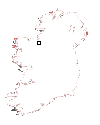
Mini-map
|
|
|
|
|
|
Site
|
|
|
|
|
 |
|
|
|
OS maps are essential for finding most sites.
Want to learn more?
About OS Maps
|
|
Want to find out more about GPS?
About GPS
|
|
Do you have a grid reference for a site and need to know which map it is on? Well, finding out is easy!
Just try the megalithomania Grid Reference Locator
|
|
Or do you want to convert Irish grid references to longitude and latitude? Or even vice-versa?
Just try the megalithomania Coordinate convertors
|
|
|
|
Nearest Weather |
|
|
|
| |
| |
| |
|
A Selection of Other Wedge Tombs |
|
|
|
|
|
|
|
|


