Loughgur
|
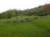
Wedge Tomb
|
|
Townland
|
Lough Gur |
|
County
|
Limerick
|
|
Grid Ref
|
R 646 403 |
|
OS Sheet |
65 |
|
Longitude
|
8° 31' 17.34" W |
|
Latitude
|
52° 30' 46.94" N |
|
Nearest Town
|
Bruff (4.3Km) |
|
MultiMap
|
View Map |
Some Nearby Mountains:
|
Knockainy |
5Km (SE) |
|
Fedamore |
7Km (NW) |
|
Knockroe |
7.4Km (N) |
|
Knocktwo |
8.7Km (SW) |
|
Knockfea |
9.8Km (NNW) |
|
|
|
|
Mini-map
|
|

|
|
|
|
Site
|
|
|
|
|
DirectionsFrom Bruff take the R512 north. At the first cross roads turn right. After 2km you will see the tomb on your right. |
|
|
 |
|
|
|
OS maps are essential for finding most sites.
Want to learn more?
About OS Maps
|
|
Want to find out more about GPS?
About GPS
|
|
Do you have a grid reference for a site and need to know which map it is on? Well, finding out is easy!
Just try the megalithomania Grid Reference Locator
|
|
Or do you want to convert Irish grid references to longitude and latitude? Or even vice-versa?
Just try the megalithomania Coordinate convertors
|
|
|
|
Nearest Weather |
|
|
 |
|
|
|
| |
| |
| |
|
A Selection of Other Wedge Tombs |
|
|
|
|
|
|
|
|