Bunnafinglas
|
Wedge Tomb
|
|
County
|
Mayo
|
|
Grid Ref
|
G 268 099 |
|
OS Sheets |
24, 31 |
|
Longitude
|
9° 7' 2.21" W |
|
Latitude
|
54° 1' 58.9" N |
|
Nearest Town
|
Foxford (5.8Km) |
|
MultiMap
|
View Map |
Some Nearby Mountains:
|
Corroy |
5.1Km (NW) |
|
Carranaragh |
7.6Km (SSE) |
|
Knocknasliggaun |
11.8Km (ENE) |
|
Knockanillaun |
11.9Km (NW) |
|
Farbreiga |
12.3Km (SW) |
|
|
|
|
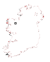
Mini-map
|
|
|
|
|
|
Site
|
|
|
|
|
 |
|
|
|
OS maps are essential for finding most sites.
Want to learn more?
About OS Maps
|
|
Want to find out more about GPS?
About GPS
|
|
Do you have a grid reference for a site and need to know which map it is on? Well, finding out is easy!
Just try the megalithomania Grid Reference Locator
|
|
Or do you want to convert Irish grid references to longitude and latitude? Or even vice-versa?
Just try the megalithomania Coordinate convertors
|
|
|
|
Nearest Weather |
|
Visit Notes
| Prev Site | | Despite having signposts from the road this one is a little tricky to find and when you do reach it there is little to see due to the massive amounts of undergrowth that is devouring it.
Someone had obviously made the effort, but I wish they hadn't bothered, because they annoyingly had left some pretty shiny ribbon behind and a few coins. I suppose these people want to make offering to 'gods' that had nothing to do with these sites. Wedge tombs were about ancestor worship, not some mythical mother goddess worship cooked up by some people who want to sell bad books.
I'm sure that Mother Nature will be indebted to whoever left this rubbish when one of her little fluffy bunnies runs through the tomb and gets snared on the ribbon, dying a horrible death by strangulation. Sometimes I wish people would THINK !!!!!! |
|
|
|
Images Click to Enlarge
Sunday, 4th August 2002 CE  _ _  _ _ |
|
|
|
|
|
|
|
|
|
|
| |
| |
|
A Selection of Other Wedge Tombs |
|
|
|
|
|
|
|
|


