Parknabinnia
|
Wedge Tomb
|
|
County
|
Clare
|
|
Grid Ref
|
R 258 933 |
|
OS Sheet |
51 |
|
Longitude
|
9° 6' 17.83" W |
|
Latitude
|
52° 59' 7.28" N |
|
Nearest Town
|
Corrofin (5.3Km) |
|
MultiMap
|
View Map |
Some Nearby Mountains:
|
Carrownagarraun |
3.8Km (S) |
|
Cappaghkennedy |
6.9Km (NE) |
|
Deroolagh |
10.6Km (S) |
|
Slievecarran |
13.8Km (NNE) |
|
Monreagh |
14.1Km (E) |
|
|
|
|
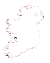
Mini-map
|
|
|
|
|
|
Site
|
|
|
|
|
 |
|
|
|
OS maps are essential for finding most sites.
Want to learn more?
About OS Maps
|
|
Want to find out more about GPS?
About GPS
|
|
Do you have a grid reference for a site and need to know which map it is on? Well, finding out is easy!
Just try the megalithomania Grid Reference Locator
|
|
Or do you want to convert Irish grid references to longitude and latitude? Or even vice-versa?
Just try the megalithomania Coordinate convertors
|
|
|
|
Nearest Weather |
|
|
 |
|
|
|
| |
| |
|
A Selection of Other Wedge Tombs |
|
|
|
|
|
|
|
|


