Loughbrack
|
Wedge Tomb
|
|
County
|
Tipperary
|
|
Grid Ref
|
R 907 592 |
|
GPS
|
R 90717 59213 (11m) |
|
OS Sheet |
66 |
|
Longitude
|
8° 8' 15.12" W |
|
Latitude
|
52° 41' 2.26" N |
|
Nearest Town
|
Silvermines (14Km) |
|
MultiMap
|
View Map |
Some Nearby Mountains:
|
Mauherslieve |
4.3Km (NW) |
|
Knockalough |
7.5Km (E) |
|
Glencarbry |
7.6Km (SSE) |
|
Foildarg |
8.2Km (S) |
|
Keeper (Hill) |
11.3Km (NW) |
|
|
|
|
Mini-map
|
|
|
|
|
|
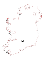
Site
|
|
|
|
|
 |
|
|
|
OS maps are essential for finding most sites.
Want to learn more?
About OS Maps
|
|
Want to find out more about GPS?
About GPS
|
|
Do you have a grid reference for a site and need to know which map it is on? Well, finding out is easy!
Just try the megalithomania Grid Reference Locator
|
|
Or do you want to convert Irish grid references to longitude and latitude? Or even vice-versa?
Just try the megalithomania Coordinate convertors
|
|
|
|
Nearest Weather |
|
|
 |
|
|
|
| |
| |
|
A Selection of Other Wedge Tombs |
|
|
|
|
|
|
|
|


