Knockcurraghbola Commons
|
Wedge Tomb
|
|
Townland
|
knockcurraghbola Commons |
|
County
|
Tipperary
|
|
Grid Ref
|
R 951 609 |
|
OS Sheet |
59 |
|
Longitude
|
8° 4' 20.96" W |
|
Latitude
|
52° 41' 57.47" N |
|
Nearest Town
|
Borrisoleigh (9.9Km) |
|
MultiMap
|
View Map |
Some Nearby Mountains:
|
Knockalough |
4Km (SE) |
|
Mauherslieve |
7.9Km (W) |
|
Glencarbry |
8.4Km (S) |
|
Knockadigeen Hill |
10Km (N) |
|
Foildarg |
11.2Km (SSW) |
|
|
|
|
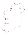
Mini-map
|
|
|
|
|
|
Site
|
|
|
|
|
 |
|
|
|
OS maps are essential for finding most sites.
Want to learn more?
About OS Maps
|
|
Want to find out more about GPS?
About GPS
|
|
Do you have a grid reference for a site and need to know which map it is on? Well, finding out is easy!
Just try the megalithomania Grid Reference Locator
|
|
Or do you want to convert Irish grid references to longitude and latitude? Or even vice-versa?
Just try the megalithomania Coordinate convertors
|
|
|
|
Nearest Weather |
|
|
 |
|
Visit Notes
| Prev Site | | I knew this tomb lay on a rise, because I had seen a skylined photo of it on Anthony Weir's web site, but I wasn't really prepared for the dramatic experience of actually seeing it like that. The approach to this has to be one of the best approaches, for that image is exactly as you first see it as you climb up to it.
The tomb is actually quite incomplete, but it is still great. The gallery is aligned NE/SW with the front at the Sw, where indications of a portico can be seen in front of the door slab. Two roof slabs remain in place as does a fair amount of the double walling, which is very close to the slabs forming the gallery. Unfortunately as you get to the back things start to get bad. One side of the gallery is almost complete, but the southern side has been robbed back to the roof slabs, which are held 1.2m above the ground.
From it's position I cannot see how this could have ever had a cairn, because the ground drops off too steeply along the sides. Saying that, with a position like this it may not have had one. It certainly doesn't need one to be impressive. |
|
|
|
Images Click to Enlarge
|
|
Sunday, 10th November 2002 CE  _ _  _ _  _ _  _ _ |
|
|
|
|
|
|
|
|
|
|
| |
| |
|
A Selection of Other Wedge Tombs |
|
|
|
|
|
|
|
|


