Agrihan
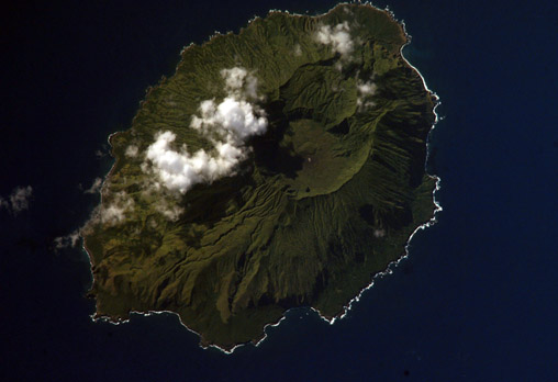
- ISS006-E-42419
- 01 April 2003
- 05:43 UTC
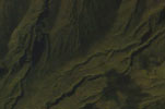
Agrihan is located midway along the northern islands of the Mariana chain, situated between Pagan (62 km to the south) and Asuncion (102 km to the north-northwest). The island is an emergent stratovolcano — the largest in the Marianas — forming an oval-shaped island of about 7 km across and covering an area of 47 km². The island consists largely of steep terrain and deep ravines, the only relatively flat land ocurring along the southeast shoreline and on the north side of the central caldera.
The Agrihan volcano rises to a height of 965 m (the highest point above sea level in the Mariana Islands) and contains a 500 m deep, steep-walled caldera measuring up to 2 km across — the caldera floor covers an area of nearly 4 km². Easily discernable in the above image are the results of the island's 1917 (and last) eruption, the lava flows of which broke through the caldera wall on the northwest side before travelling to the sea and creating the lobe-shaped extension (at top-right in the image) to the island's mostly steep and rocky coastline. A few areas of the coast are lined by beaches of black volcanic sand.
Vegetation on the island conists of Swordgrass (Miscanthus floridulus) dominated grasslands on the upper slopes, forests of Coconut palm (Cocos nucifera), with some Breadfruit (Artocarpus altilis) and Papaya (Carica papaya) on the lower slopes. Areas of rain forest are found within the deep ravines and gorges that descend radially from the summit.