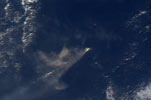
Anatahan
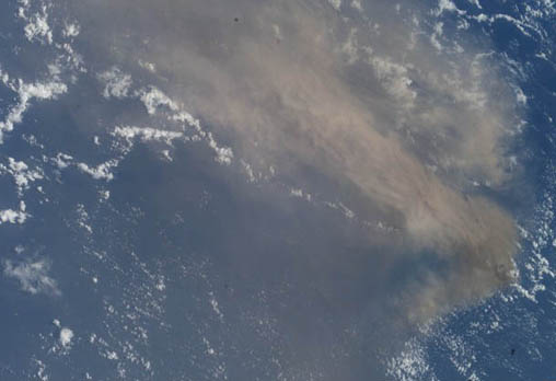
- ISS007-E-5369
- 11 May 2003
- 00:19 UTC
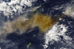
Anatahan is located midway along the Mariana arc of islands, situated 53 km northwest from the Farallon de Medinilla and 37 km southwest from Sarigan. Its nearest large neighbour is the island of Saipan located 117 km directly south.
With an area of 32 km², Anatahan has an elongate form measuring 9 km in length (orientated west to east) and averages 3 km across (north to south). The island is composed of two overlapping volcanoes reaching a height of 788 m at the western volcano. The centre of the island is of lower elevation, being formed by the overlapping summit calderas of the two volcanoes. The largest caldera, measuring 2.3 km by 3 km, is located in the west.
The above image captures the 11 May 2003 eruption on Anatahan (the island itself is completley obscured by ash clouds). This was the first historically-recorded eruption of Antahans's volcano. The eruption beagan on the 10 May producing an ash plume that reached heights of 10,000 m. Since then, the volcano has erupted on several further occasions: from April through to mid-July 2004, and in January 2005. The largest recorded eruption of Antahan began on 6 April 2005 — the explosive activity sent 50 million km³ of dust and ash to heights of over 15,000 m.