
Wales Island
- Terra MODIS image
- 31 July 2006
- 17:30 UTC
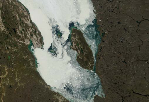
 Wales Island is located on the eastern side of
Committee Bay (the southernmost sections of the 800 km long Gulf of Boothia). It lies just 1.5 km off the southwestern coast of the
Melville Peninsula, with the Simpson Peninsula (left edge of the above image) a further 51 km to the west across the bay. The remote
Arctic community of Repulse Bay is situated 130 km the south on the the opposite side of the Melville Peninsula.
Wales Island is located on the eastern side of
Committee Bay (the southernmost sections of the 800 km long Gulf of Boothia). It lies just 1.5 km off the southwestern coast of the
Melville Peninsula, with the Simpson Peninsula (left edge of the above image) a further 51 km to the west across the bay. The remote
Arctic community of Repulse Bay is situated 130 km the south on the the opposite side of the Melville Peninsula.
The 1,137 km² island has dimensions of 63 km by 23 km and consists of a low-lying plain marked by loosely compacted sediments, small lakes and areas of tundra ponds. Elevations gradually increase towards the centre of the island where maximum heights of 80 m above sea level are reached.
image: MODIS rapid response project at nasa/goddard space flight center.


